
Tri-State Marker
Address:
Latitude & Longitude:
Saves:
39
Check-Ins:
28
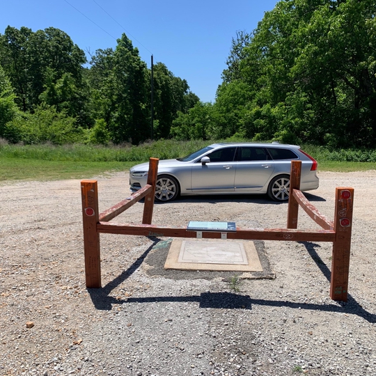
Description:
The Tri-State-Marker is the place where Kansas, Oklahoma, and Missouri meet. More impressive is the manpower and time that it took to map the area in 1857. An astounding 800-man expedition spent half-a-year surveying just 40 miles. In 1938, a stack of stones was used to mark a spot that was thought to be the tri-state area but the location was erroneous. This mistake wasn't corrected until 2004 when the new plaque was set into the ground 50 feet east of the old monument.
Website:
Tags:
History • Scenic

Tri-State Marker
Tri-State Marker

Tri-State Marker
Tri-State Marker

Tri-State Marker
Tri-State Marker
Tri-State Marker
Tri-State Marker

Tri-State Marker
Tri-State Marker

Tri-State Marker
Tri-State Marker

Tri-State Marker
Tri-State Marker

Tri-State Marker
Tri-State Marker

Tri-State Marker
Tri-State Marker

Tri-State Marker
Tri-State Marker

Tri-State Marker
Tri-State Marker
